
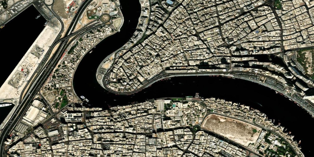
Dubai Creek
Dubai Creek
A historic sea artery dividing Deira and Bur Dubai. This is where the city began.
Description
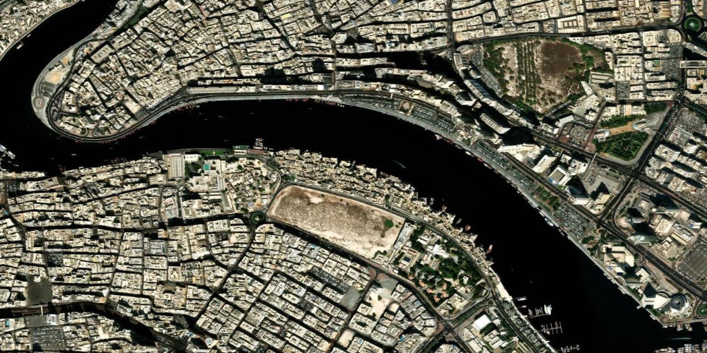
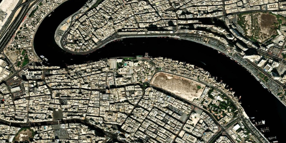
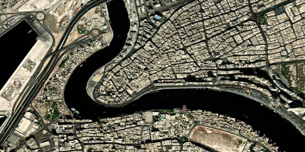
Dubai Creek is a historic sea artery dividing the old districts of Deira and Bur Dubai. It was around the creek that Dubai began as a trading and fishing port.
Today, traditional abra boats and cargo dhows ply the creek, and markets and old quarters survive along its banks. A trip on the water is one of the most atmospheric ways to feel old Dubai.
Tip: Crossing the creek by abra boat costs a symbolic 1 dirham.
Фото
Фото: Unsplash
Planning your visit
Best time
Sunset — the best time for an abra ride and photos.
How much time to allow
30–60 minutes for the crossing and the waterfronts.
Tickets & prices
Prices are approximate and depend on the slot and conditions — check when buying.
On the map
Interactive satellite map — zoom and pan to explore the place and its surroundings.
Good to know
How to get there
Frequently asked questions about Dubai Creek
What is Dubai Creek?+
It is a historic sea channel dividing Deira and Bur Dubai. The city grew up around it as a trading port.
How much does an abra crossing cost?+
A ride on a traditional abra boat across the creek costs about 1 dirham and is paid in cash at the dock.
What is there to see at Dubai Creek?+
The Deira markets (gold and spices), the historic Al Fahidi quarter and traditional dhows at the wharves.
What's nearby
Nearby spots — easy to combine into one route.
 Entertainment
 Museum of Illusions
Museum of IllusionsИнтерактивный музей оптических иллюзий и головоломок в историческом районе Аль-Сиф у Дубайской бухты.
Tip: Берите телефон или камеру — почти все экспонаты созданы для забавных фото.
 Culture
 Квартал Аль-Фахиди
Al Fahidi Historical NeighbourhoodСтарейший сохранившийся квартал Дубая с лабиринтом узких улочек, домами из коралла и глины и характерными ветроуловителями (барджиль).
Tip: Приходите рано утром или ближе к закату — днём в узких переулках жарко и почти нет тени.
 Culture
 Gold Souk
Gold SoukA famous gold market in Deira with hundreds of jewellery shops, where haggling is the norm.
Tip: The price is made up of the weight of the metal plus the workmanship — haggle, the first price is always inflated.
Similar places
 Culture
 Museum of the Future
Museum of the FutureA ring-shaped building with Arabic calligraphy on its facade. Inside — immersive exhibitions about the future.
Tip: Tickets sell out days ahead — book online.
 Culture
 Jumeirah Mosque
Jumeirah MosqueOne of the city's most beautiful mosques and the only one open to non-Muslims as part of guided tours.
Tip: Modest, covered clothing is required; a headscarf is provided to women on site.
 Culture
 Spice Souk
Spice SoukA colourful spice market in Deira with saffron, tea, incense, nuts and dried fruit.
Tip: Taste before you buy and haggle — it is perfectly normal here.